FOREST GATE, UPTON & PLASHET.
| The name Forest Gate was derived from the fact that there used to be a gate to Epping forest here which prevented cattle from straying. The area remained rural until the nineteenth century. In the 18th and early 19th century a number of city dwellers had large country houses in the southern part known as Upton. Many of these were Quakers, the best known of these were the families of Gurney, Fry and Lester. They worshipped in the Friends meeting House then in North Street, Plaistow. |
PUT MOUSE OVER  TO READ NAME ~ CLICK FOR PHOTO & EXPLANATION.
CONTENTS | ||
| 1. THE BOY VC. | 2. BRIDGE ART. | 3. CAIRN. |
| 4. CLOCK. | 5. DURNING HALL. | 6. "EAGLE & CHILD" |
| 7. "THE EVANGELIST" | 8. FIREMAN'S HELMET. | 9. FISHERMEN. |
| 10. HISTORIC FLOWER POT. | 11. FOOTBRIDGE ART. | 12. JOSEPH FRY FOUNTAIN. |
| 13. "THE GUARDIAN" | 14. FLORIST'S KIOSK. | 15. "LIVE & LET LIVE" |
| 16. MARKET PLACE. | 17. MEGGS ALMS HOUSES. | 18. OLYMPIC PANORAMA. |
| 19. "OWL" | 20. PLASHET LIBRARY. | 21. PLASHET PARK |
| 22. POINTS OF THE COMPASS. | 23. RELIGIOUS PREJUDICE. | 24. ROTHSCHILD MAUSOLEUM |
| 25. ST. ANTONY'S PRIMARY SCHOOL. | 26. DECORATIVE SEATING | 27. "THE SPOTTED DOG". |
| 28. STATION. | 29. SWAMINARAYAN TEMPLE | 30. TATOOIST'S SIGN. |
| 31. TONIC SOL-FA COLLEGE. | 32. "TREE OF LIFE". | 33. WEST HAM BORDER MARKERS. |
 |
The Boy VC. |
|
Manor Park Cemetery. Entering by the Sebert Road gate, and heading towards the central chapel after a short distance you will see the gravestone almost in front of you on a corner. Jack Cornwell was born in 1900 and lived in little Ilford. At the age of 15 he enlisted in the Royal Navy. In the Battle of Jutland in 1916 he was serving a gun crew on HMS Chester. Early in the battle he was mortally wounded, but stayed at his post awaiting orders. For this he was awarded the Victoria Cross. Initially he was buried in a communal grave, but after a public outcry he was reburied in this grave with full naval honours. Today, one wonders how a boy cadet of 16 was allowed to enter a combat zone. (See No. 1. on the MAP ) | ||
 |
Bridge Art. |
|
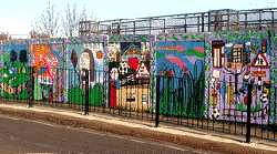
The bridge carrying Balmoral Road over the railway has painted panels on each side of the road. The paintings were done by the pupils of Forest Gate Community School, Woodgrange Infants, Godwin Junior Schools together with ELBWO and local residents. There is a quotation displayed reading: "There is a universal poetry in all things". (See No. 2. on the MAP ) Date Summer 2000. | ||
 |
Cairn. |
|
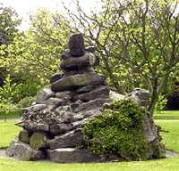
West Ham Park. This cairn was erected to mark the site where Ham House once stood, and was constructed from some of the masonry from the house that was pulled down in 1872.. A large house had stood here from the 16th century, and was called by various names such as Grove House and Rooke Hall. C. 1770 it was owned by Dr. John Fothergill who planted Botanical Gardens which eventually developed into West Ham Park. On the other side of Upton Lane there had stood a house called Upton House where in 1827 Joseph Lister was born in 1827. Lister was responsible for introducing antiseptic procedures into surgery. Elizabeth Fry, the prison reformer, lived in a house in Portway. Many famous personages visited her here, including Frederick, King of Prussia. West Ham Park was also referred to as Upton Park. One wonders just how many people coming to see West Ham football team playing home matches associate the ground with this park. (See No. 3. on the MAP ) | ||
 |
Clock. |
|
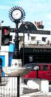
On a traffic island at the junction of Forest Lane and Woodgrange Road. The clock is combined with a drinking fountain and a Horse & cattle trough. Although this has been moved from it's original position, it still has with it two rectangular stone blocks. These were put there to make it easier for easier for riders to remount their horses after they (the horses probably) had taken a drink. When originally set up this was in the middle of the market. (See No. 4. on the MAP INLAY ) | ||
 |
Durning Hall. |
|
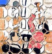
Earlham Grove. This is a small detail from a larger work of a tiled mural on the front of this community centre. The centre has developed out of a Unitarian Settlement which opened in Limehouse in 1884. It now houses a number communal facilities run by Newham Council. The mural was funded by the Newham Council Leisure Services and is the work of many hands. (See No. 5. on the MAP INLAY ) Artists: Marjorie Man, Pauline, Richard, Liney, J H Patel, T H Clark, Ann, Nicola Taff, Danny, Michael Obioep, June Child. Date: June 1996. | ||
  |
"The Eagle & Child." |
|
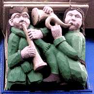
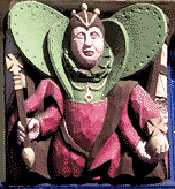
Two of the five coloured wood carvings by the door of this public House, which convey the spirit of Merrie England. Musicians are on the left and Queen Elizabeth I with orb and sceptre on the right. There has been a pub on this site with this name for at least 260 years, but the present building only goes back to 1896. The name is derived from the legend that Sir Thomas Latham, who had no natural heir, adopted a baby boy that was found on his estate under a tree guarded by an eagle. The child was named Fitzhenry, but after inheriting the estate, he changed his name to Latham. Later his daughter married into the Stanley family one of whose descendants was made the Earl of Derby. The eagle and child feature on that family's coat of arms. At the time of writing (2007), the pub is unoccupied and boarded up, but the carvings are clearly visible. (See No. 6. on the MAP INLAY ) | ||
 |
"The Evangelist". |
|
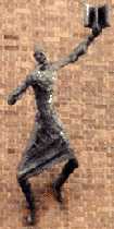
Sculpture on the front of the Forest Gate Methodist Church, Woodgrange Road. The preacher is holding a book. The Sculpture leans out from the brickwork at quite an alarming angle. It is held in this position by being counterbalanced by the church organ inside the building. (See No. 7. on the MAP INLAY ) Sculptor: Peter Peri. 1962. | ||
 |
Fireman's Helmet. |
|
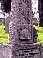
West Ham Cemetery, Cemetery Road. This stone was erected to the memory of two firemen killed in the Silvertown Explosion of January 19th 1917. It is stated that they were killed in the execution of their duty. When fire broke out in one of the factory buildings, Vickers and Snell immediately went on to the site, despite knowing that there were large stocks of explosives there. They were killed in a vast explosion, which soon followed. Another fireman J.J. Betts survived after having been blown 200 feet, while the mangled remains of the fire engine were found nearly quarter of a mile away. The stone can be found slightly to the left of the main path about 60 yards into the cemetery, (See No. 8. on the MAP ) | ||
 |
Fishermen. |
|
Small terracotta tile on 13 Upton Avenue. This is the corner house. Numbers 1 - 11 are missing. This house is probably the oldest in the area, and though much altered, parts may date back to the mid 1700s. It reminds us that the Upton once contained a number of large houses built for affluent folks from the city. Often referred to as the Red House, it has other carvings facing Upton Lane. The motto beneath the shield over the front door is: There is much to be done. The monogram on the shield may be that of a member of the Tothill family who lived here in the 19th century. (See No. 9. on the MAP ) | ||
 |
Historic Flower Pot. |
|
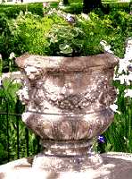
West Ham Park, at the top of a small flight of steps near the tennis courts. This is one of a pair of decorative flower urns which came originally from Wanstead House. They were no doubt purchased in the sale when in about 1823 William Pole-Tilney-Long-Wellesley, a nephew of the Duke of Wellington, sold off the contents of the house and gardens after he had squandered away his wife's inheritance. The urns may well date from the time when Samuel Gurney (1786 � 1856) was living in Ham House and the present West Ham Park was part of his gardens. (See No. 10. on the MAP ) | ||
 |
Footbridge Art. | |
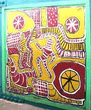
One of a series of panels on the footbridge over the railway between Norwich Road and Forest Lane. A few of the panels are signed but this one has no signature. (See No. 11. on the MAP ) Date 1998. | ||
 |
Joseph Fry Drinking Fountain. | |
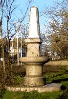
On Wanstead Flats near the corner of Capel Road and Centre Road. Joseph Fry (1809-1896), the son of Elizabeth Fry, was responsible for the erection of drinking fountains for both people and horses. It was therefore a very fitting way to honour his memory. To the east of the fountain on the other side of the pond where there is now a circle of trees, there used to be a bandstand, which was used for open air concerts. In 1937, the day of the coronation of King George VI, crowds joined in the open air dancing here. In the early part of the 20th century, the pond, called Angel Pond after Lewis Angell surveyor and engineer who planned it, had paddle boats for children, park benches for the adults and fashionably dressed people used to walk along the path to listen to the band. The local people often referred to it as "Monkey's Parade". This was, therefore, a posh park, which explains why the local station was called Wanstead Park, although it is a mile away from the present Wanstead Park. In the early 18th century George III reviewed 10,000 troops on the Flats. During World War 2 there was a battery of anti-aircraft guns stationed on the Flats. (See No. 12. on the MAP ) | ||
 |
"The Guardian" |
|
Forest Lane Park entrance in Magpie Close, situated behind the main block of flats. A Wooden sculpture depicting a nursing sister holding an infant. The flats were previously Newham Maternity Hospital which explains the choice of subject. Also in the same park is another wooden carving by the same sculptress called "The Tree of Life", which is in the children's play area in front of the main building. (See No. 13. on the MAP ) Sculptress: Helen Stylianides, 1997. | ||
 |
Florist's Kiosk |
|
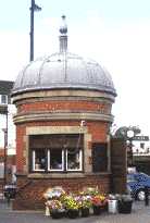
Woodgrange Road, in front of the station. The domed roof of this kiosk originally was a feature of the railway station, but was removed when the station was refurbished. The turret with the dome was originally fixed to the corner of the main building. (See No. 14. on the MAP INLAY ) | ||
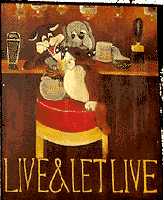 |
"Live & Let Live." | |
Pub sign at 272 Romford Road. Although designed after 20th century cartoon characters, the pub is much older. The origin of this strange name is said to be that in one English village the Publican started to sell household goods from his pub, which upset the owner of the village shop. So the latter applied for a licence to sell liquor and called his pub The Live and Let Live. However, the name may also have been a reaction to those campaigned against the selling and drinking of alcohol. (See No. 15. on the MAP ) | ||
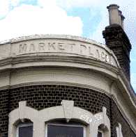 |
Market Place | |
Above the Dental Practice on the corner of Sebert Road and Woodgrange Road. This is a reminder that this road junction marks the site where the local market used to be. Woodgrange is an old name it was the name of a manor which was near the present junction of Capel Road and Chestnut Avenue. Woodgrange means the farm in the forest (Epping). Richard de Montfitchet donated the farm to Stratford Longthorne Abbey. In 1189 King Richard I granted the monks protection from interference on this land. (See No. 16. on the MAP INLAY ) | 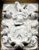 |
Meggs Alms Houses |
273 Upton Lane. In the late 1600s William Meggs donated money for 12 almshouses which were built on the south side of Whitechapel Road. In 1883, these were sold to the East London Railway Co. The Upton Lane almshouses were built to replace them. (See No. 17. on the MAP ) | ||
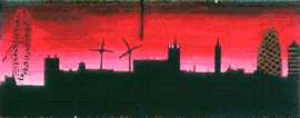 |
Olympic Panorama | |
Part of a series of murals round the playground of Forest Gate Community School, which can be viewed from Forest Lane. This panel shows the London skyline at sunset and includes the Gherkin and the London Eye. Residents of East London know that the sun regularly sets over London. (See No. 18. on the MAP ) | ||
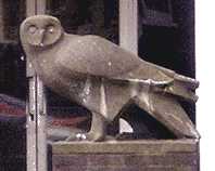 |
"Owl" | |
In front of the entrance to Stratford School, which is at the junction of Doris Road and Upton Lane. Presumably the owl was chosen by the school because it is reputed to be both wise and knowledgeable. (See No. 19. on the MAP ) Sculptor: K. Codinus 1958 | ||
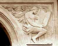 |
Plashet Library | |
Plashet Grove. This figure in a pseudo classical style is reading from a book was chosen to symbolise the library. On the other side of the main entrance is a similar figure reading from a scroll. Over the doorway is the East Ham coat of arms. (See No. 20. on the MAP ) Date: 1899. | ||
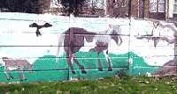 |
Plashet Park Mural | |
Plashet Grove. There are two large murals painted on the northern wall of the park. They feature animals and birds from different parts of the world. (See No. 21. on the MAP ) | ||
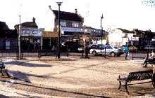 |
Points Of The Compass. | |
The pavement on the corner of Sebert Road and Woodgrange Road there is a large circle about 14 yards/metres in diameter. It is surrounded by four seats and has a large cross in the centre whose arms point to the cardinal points. At the end of these are the letters N, E, S and W. (See No. 22. on the MAP INLAY ) | ||
 |
Religious Prejudice. | |
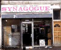
Sebert Road. Barber's Shop labelled "Synagogue". This is an example of antisemitism, which has shamefully been allowed to remain on public display for many years. One wonders if this would have happened if it had been labelled Roman Catholic Church or Mosque. At one time there was a large population of Jews in the area but they stayed for only two or three generations before continuing their migration from the Whitechapel to Redbridge. The real Synagogue was in Earlham Grove and can still be seen there, but it is boarded up and has now (2007) been taken over by developers. (See No. 23. on the MAP INLAY ) | ||
 |
Rothschild Mausoleum. | |
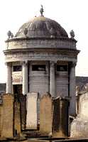
Jewish cemetery, Buckingham Road. This was erected to the memory of Evelina de Rothschild the daughter of Baron Lionel de Rothschild who after being elected to parliament five times previously, finally became, in 1858, the first Jewish MP. Evelina married her cousin Baron Ferdinand de Rothschild and died in childbirth in 1866. Both Ferdinand and Evelina are buried here. Also in the cemetery is the grave of Sir David Salomons who in 1855 became the first Jewish Lord Mayor of London. He was also the first Jew to speak in parliament. When he was elected in 1851, like Lionel de Rothschild he refused to take the inaugural oath "on the true faith of a Christian". But unlike Rothschild, he took his seat and spoke (illegally) in the debate that followed, before being ejected by the Serjeant-at-Arms. The cemetery can only be visited by appointment; but one can get a good view from the West Ham Cemetery next door from where this photo was taken. (See No. 24. on the MAP ) For old Cemeteries in the East end see Old Jewish Cemeteries and Synagogues | ||
  |
"St Antony's Primary School" | |
St Antony's Road. Two rather unusual murals to be found decorating the exterior walls of a Primary school. (See No. 25. on the MAP ) | ||
 |
Decorative Seating | |
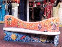
Green Street. One of several brightly tiled ornamental mosaic seats placed around an area with decorated pavement. The seat shown here depicts different types of fruit including a pineapple. This pavement is on the border of E6 and E7 See East Ham for another photo and for the names of the artists involved. (For the seat see No. 26. on the MAP ) | ||
 |
"The Spotted Dog" | |
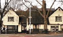
This public house which has wooden cladding on the walls gives the appearance of a village pub in the middle of very urban surroundings. The spotted dog after which the pub was named was probably not a Dalmatian, but one of the English hunting hounds. Perhaps the name arose because of the nearness of Epping Forest. In 1665 at the time of the great plague, the Pub was used by merchants, who had fled the city of London, as temporary exchange for business purposes. At the time of writing (2007) it seems to be undergoing repairs. (See No. 27. on the MAP ) | ||
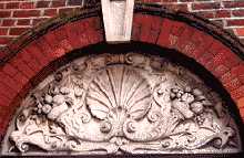 |
Station. | |
Woodgrange Road. Part of the old Forest Gate station decorations preserved after the frontage was modernised. The station was first opened in 1841 by the Eastern Counties Railway, but the piece illustrated dates from later in that century. (See No. 28. on the MAP INLAY ) | ||
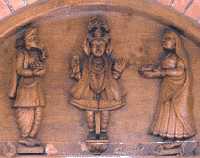 |
SKS Swaminarayan Temple | |
Shaftsbury Road. Carvings over the doorway. The doors are also elaborately carved with figures in the same style. This is a Hindu Temple which follows the teachings of Bhagwan Swaminarayan (1781 � 1830). (See No. 29. on the MAP ) | ||
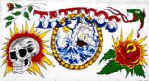 |
Tattooist Sign | |
Hand painted sign outside the Tattooist's in Balmoral Road. (See No. 30. on the MAP ) | ||
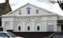 |
Tonic Sol-Fa College | |
Earlham Grove. Behind this Church of the Cherubim and Serephim , one can just see some tall buildings dating to the 19th century. This was the college set up by Revd. John Curwen, to propagate the Tonic Sol-Fa method of writing music and teaching singing. The college was called the Forest Gate School of Music. The present church was a later hall attached to the college. (See No. 31. on the MAP ) | ||
 |
"Tree of Life" | |
A kind of Totem pole in the shape of an unopened mushroom. This wooden carving stands in the children's playground section of Forest Lane Park and Lodge, entrance in Magpie Close. The totem pole has various other small designs incised in it. (See No. 32. on the MAP ) Sculptress: Helen Stylianides. | ||
  |
West Ham Border Markers | |
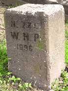
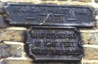
Two markers of the boundary of West Ham Parish. The one on the left is in the middle of West Ham Cemetery close to the central path and on the North West corner of block NG. It is dated 1896 and is inscribed WHP for West Ham Parish. (See No. 33. on the MAP ) Since that date the boundary has been changed to include all of the cemetery. The Photo on the right shows two cast iron notices on the side of No. 181 Odessa Road. The lower one states: W.H.P. BOUNDARY IS NINE FEET N.W. OF THIS HOUSE. (See No. 33a. on the MAP ) | ||
OTHER AREAS COVERED:-
|| Beckton || Bethnal Green || Blackwall || Bow || Bromley-by-Bow || Canary Wharf || Canning Town || Chingford || Cubit Town || Custom House || East Ham || East India Dock || Higham's Park || Leyton || Leytonstone || Limehouse || Little Ilford || Manor Park || Mile End || Millwall || North Woolwich || Plaistow || Plashet || Poplar || St George's || St Katharine Dock || Shadwell || Shoreditch || Silvertown || Snaresbrook || Spitalfields || Stepney || Stratford || Upton || Walthamstow East || Walthamstow Village || Walthamstow West || Wanstead || Wapping || West India Dock || Whitechapel || Woodford || |