 |  |  |
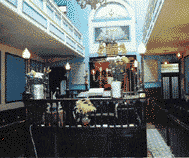
Synagogue. | Synagogue. |
Just because Blooms has left the East End it does not mean that all Jewish life has ceased in the area. It is thought that there are probably about 3000 Jews still living in the East End. That is "the Near East" and not "the Far East" of Forest Gate or Redbridge. The Stepney Jewish Day Centre has about 700 people pass through its doors each week.
 The reference numbers are colour coded on the on THE MAP.
The Jewish Communal organisations which are open are:-
There are also Jewish food shops in the area, like Carmel Wines on Mile End Road, which is strictly Kasher. There are also some which do not come under a Beth Din like Rinkoffs the Bakers in O'Leary Square, which have excellent Challahs, and also two Bagel Bakes at the top end of Brick Lane where you can get filled bagels, very reasonably priced.
THINGS TO SEE
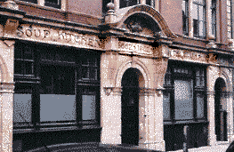
A visitor to the East End can see many reminders of the time when there were more Jews there. Many of the old Synagogue buildings are still standing, but they are now being used for other purposes.
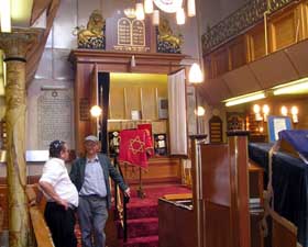
SYNAGOGUES STILL HOLDING SERVICES
| | |
Synagogue. | Synagogue. |
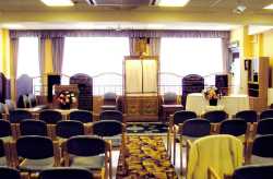
CLUBS AND SETTLEMENTS
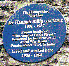
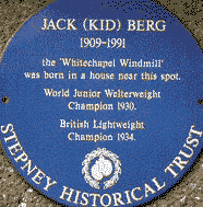
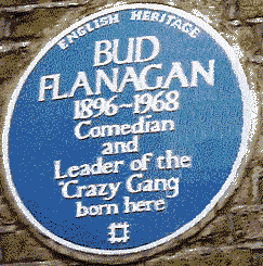
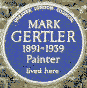
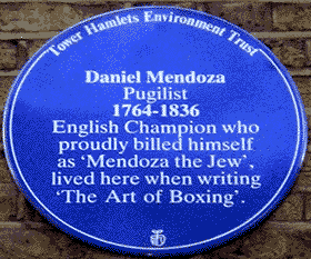
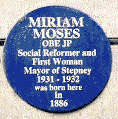
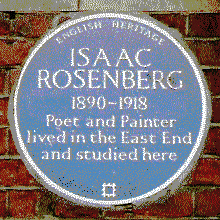
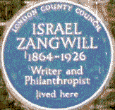
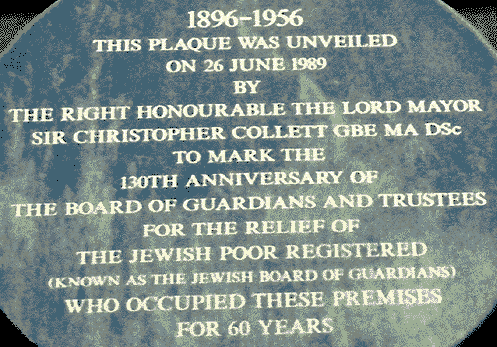
BLUE PLAQUES
 |  |  |
 |
Cable Street. |
 |
 |
 |  |
 |
 |
 |
 |
 |  |  | |
Memorial. | Drinking Fountain. | King Edward Fountain. | Drinking Fountain. |
 |
 |  |
The Jewish Poor. |
Buildings, Gateway. | Hospital. |
 |
 |  |
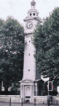
Clock Tower |
School Gates. |
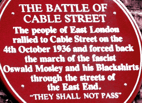
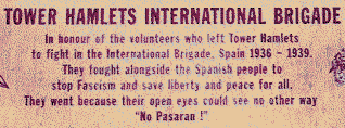
Cable Street Mural. A large mural on the wall of the old library in Cable Street (best viewed from Library Place), which commemorates the Battle of Cable Street in 1936, when the Jewish inhabitants joined with the dock workers preventing the Fascist Black Shirts from marching through the East End. ( MAP. No. 18. ) | 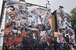 |
 |  |
 |  |
 |  |  |
 | 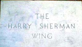 |
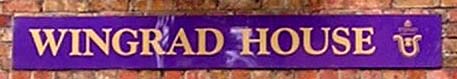
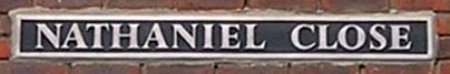
In the 1950s during the rebuilding after World War 2, Stepney council decided to name the new buildings after victims of the bombing. They selected the names by drawing them out of a hat. As the borough had a large Jewish population, several of the names chosen were Jewish. They included:
 | |
Underground Station |
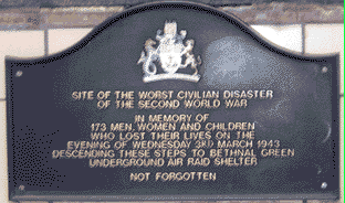
During the bombing in 1943, it was decided to place a of rocket-firing anti-aircraft battery in Victoria Park. The local population were not informed of this new weapon. So on the first night that the battery went into action, the unexpectedly loud noise caused the people going to the shelter in the local underground to think that a new weapon was being used against them. In the panic to get out of danger they rushed down the stairs, someone tripped and 173 people were crushed to death. Many of the victims were Jewish. This plaque has been placed on the Eastern entrance to Bethnal Green underground station, at the junction of Cambridge Heath Road and Roman Road.
These notes are probably not complete lists of interesting Jewish sites or sights.
During the summer months there are a number conducted walks looking at the Jewish East End. The series of booklets by Aumie Shapiro are recommended for reading.